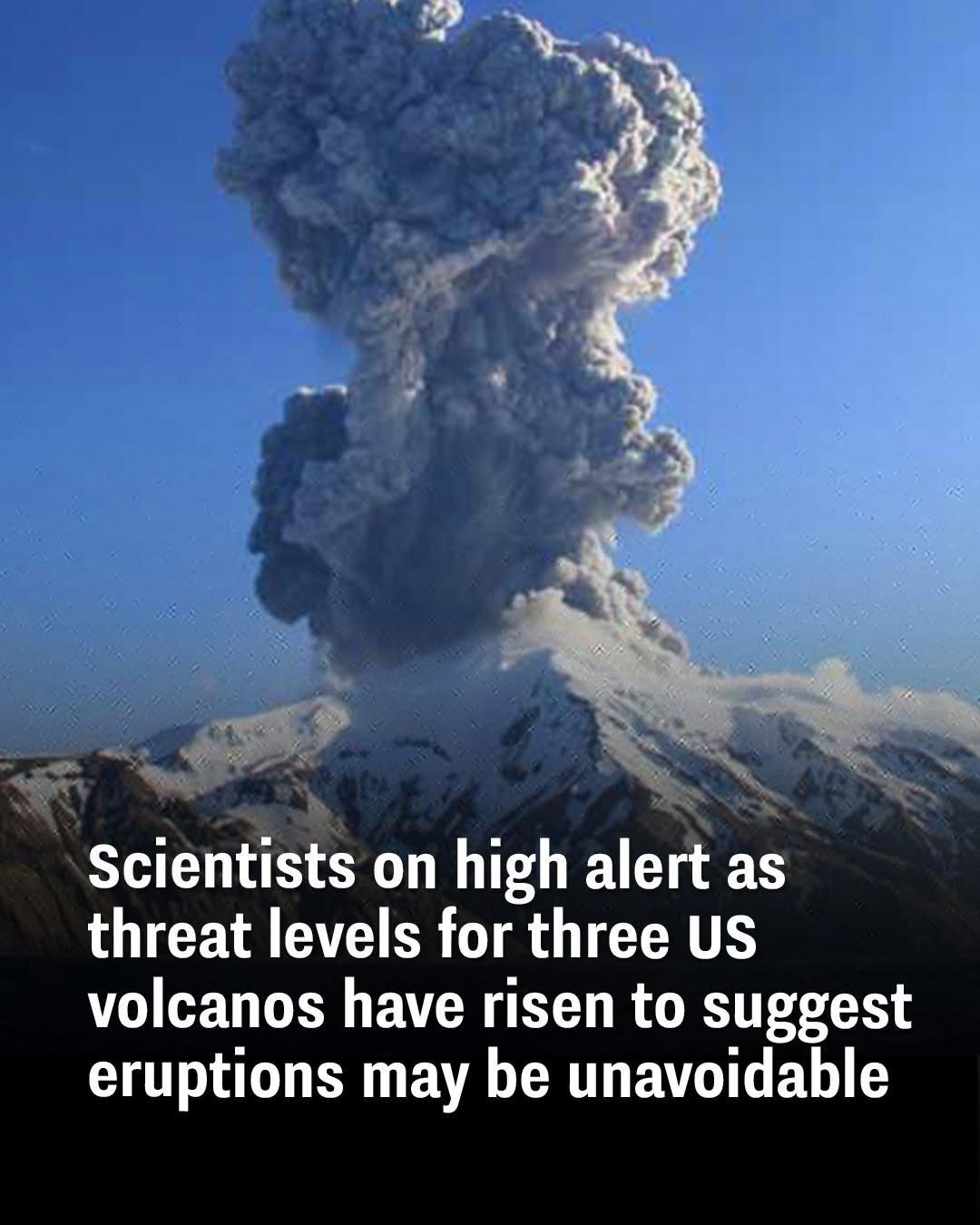
Volcanologists are sounding the alarm as three volcanoes in the United States show heightened signs of unrest. Alaska’s Great Sitkin and Mount Spurr, along with Hawaii’s Kilauea, have each experienced increasing seismic activity that could signal potential eruptions in the near future. The most concerning updates come from Great Sitkin, now at “Watch” status—the third tier in a four-level alert system—following several minor quakes and visible lava at the summit crater. Mount Spurr, which lies roughly 75 miles west of Anchorage, has seen a dramatic spike in earthquake activity. Back in April 2024, the region recorded about 30 small quakes per week; now that number has soared to approximately 125, suggesting a 50% chance of eruption. Meanwhile, Hawaii’s iconic Kilauea volcano erupted for the ninth time since December 2024 on February 11, shooting lava up to 300 feet into the air. Although no homes have been affected so far, authorities remain on edge about potential ash fallout and airborne volcanic glass.
This surge in seismic activity isn’t just random background noise—it’s the earth’s way of signaling internal shifts. Scientists report intensified earthquake swarms near each of the three volcanoes, which typically point to magma moving closer to the surface. These tremors are being tracked using advanced monitoring systems that also detect ground swelling and gas emissions—two more red flags for an impending eruption. When you combine all of these warning signs, it paints a concerning picture that these volcanoes could erupt with very little notice. Communities near these regions are being encouraged to stay vigilant, monitor emergency alerts, and have evacuation plans in place.
The increasing presence of magma below the surface is especially worrisome for people living in close proximity to the volcanoes. As molten rock pushes upward, it creates intense pressure within the volcanic system. This pressure can manifest in stronger earthquakes, sudden ground shifts, and the release of hazardous gases like sulfur dioxide. Even areas that aren’t directly in the path of a lava flow could be affected by ash clouds or infrastructure damage. Emergency planners are urging residents to stay informed, prepare emergency kits, and have a solid plan for evacuating if needed.
What’s especially unsettling is that none of these volcanoes were previously on the radar for immediate concern. Great Sitkin and Mount Spurr had been relatively quiet in recent years, and even Kilauea’s frequent activity had somewhat lulled locals into a sense of routine. But things are changing. Scientists are now closely tracking shifts in gas output and land deformation, which, along with the seismic spikes, suggest a new phase of volcanic unrest. High-resolution satellite images and real-time sensors offer valuable insights into how these volcanoes are behaving—helping volcanologists better predict what may happen next.
Past eruptions provide important lessons for current conditions. For example, Mount St. Helens’ catastrophic eruption in 1980 remains a benchmark in how sudden and powerful volcanic events can be. Similarly, Kilauea’s long history of eruptions has helped scientists identify recognizable patterns in magma movement and tremor activity. The current developments in Great Sitkin and Mount Spurr echo early signs seen in those historical eruptions, making experts even more cautious. Studying the past helps researchers improve predictive models and create more effective warning systems.
Modern volcano monitoring is a highly advanced science. Experts use seismic data to track earthquakes, deformation instruments to measure ground swelling, and chemical sensors to detect changes in gas composition. Satellite imagery adds another layer of surveillance, allowing scientists to detect thermal anomalies and surface changes that might indicate lava is nearing the surface. By pulling all this data together, volcanologists can generate detailed risk assessments that guide evacuation orders and emergency plans. With current activity ramping up at all three volcanoes, these tools are critical in keeping communities safe.
So, which areas should be on high alert? Great Sitkin poses a serious risk to the Aleutian Islands. An eruption could blanket towns in ash and severely impact air travel routes in the region. Mount Spurr, much closer to a major population center, could cause substantial disruption in Anchorage if it erupts—particularly from ash plumes that affect transportation, electricity, and breathing conditions. Kilauea, though mostly active within the boundaries of Hawaii Volcanoes National Park, still poses danger to surrounding neighborhoods due to fast-moving lava and harmful gases that could necessitate rapid evacuations.
What happens if these volcanoes do erupt? The effects could vary from lava flows that destroy infrastructure to ash clouds that shut down airports and cause respiratory problems. Toxic gas emissions could spread beyond the immediate eruption zone, creating additional health risks. Local and federal emergency agencies are already coordinating potential response efforts, while scientists work tirelessly to refine forecasts. Although predicting the exact timing of an eruption remains tricky, authorities stress that being prepared is better than being caught off guard.
In summary, Great Sitkin, Mount Spurr, and Kilauea are all showing signs that they may be entering more active phases. With magma levels rising, tremors intensifying, and gas levels shifting, the warning signs are clear. Communities in at-risk areas should stay informed, remain alert, and follow guidance from emergency officials. When it comes to volcanoes, nature rarely gives advance notice—but science and preparation can help reduce the risks.