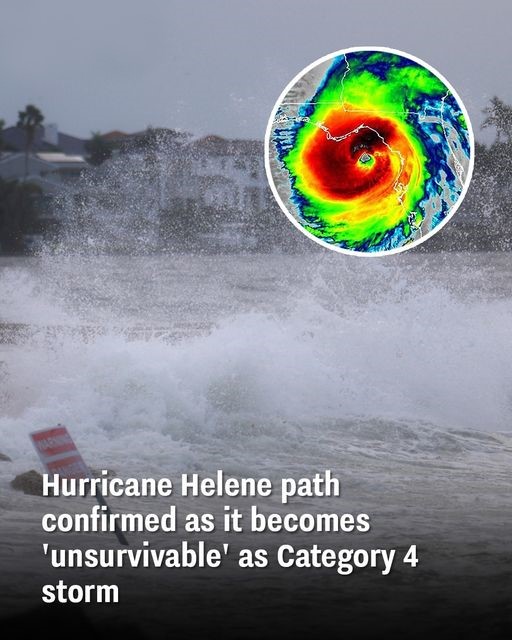
Hurricane Helene Hits Florida as Category 4, Downgraded but Remains Dangerous
Hurricane Helene made landfall in Florida as a powerful Category 4 storm but has since weakened to a Category 1 as it continues on its projected path. The National Hurricane Center (NHC) has been closely monitoring the storm, which still poses a significant threat as it moves through the southern U.S.

When Hurricane Helene Struck
On Tuesday, the NHC warned of Hurricane Helene’s potential for rapid intensification in the eastern Gulf of Mexico, predicting it would become a major hurricane by the time it reached the northeastern Gulf Coast on Thursday. They emphasized the increased risk of “life-threatening storm surge and damaging hurricane-force winds” along the Florida Panhandle and the state’s west coast.
Hurricane Helene officially made landfall in Florida at around 11:10 p.m. ET on Thursday. At the time, it was classified as a Category 4 storm, with maximum sustained winds recorded at 130 mph (215 km/h) and a central pressure of 947 mb (27.96 inches), as detected by a NOAA Hurricane Hunter aircraft.
A Category 4 hurricane, as defined by the Saffir-Simpson Hurricane Wind Scale, has wind speeds between 130-156 mph and is capable of causing catastrophic damage. This level of storm can severely damage well-built homes, leading to loss of most roof structures and even some exterior walls. It can also uproot trees, down power poles, and cause significant power outages that can last weeks or even months, making areas uninhabitable for extended periods.
The Storm’s Ongoing Path and Impact
Hurricane Helene has since weakened to a Category 1 storm, with wind speeds between 74-95 mph. Despite being downgraded, it is still considered “very dangerous,” with the potential to cause structural damage to homes and extensive damage to power lines.
The latest updates from the NHC indicate that the hurricane’s eyewall began moving into southern Georgia around 1 a.m. EDT on Friday morning. The storm is expected to move quickly north-northeast, bringing life-threatening storm surges, strong winds, and heavy rains to affected areas.
By 2 a.m. EDT, Helene had already progressed rapidly into southern Georgia, sustaining maximum winds of 90 mph, with gusts exceeding that. The storm’s most recent status update indicates that it is causing damaging gusts and life-threatening flooding across the Southeast and Southern Appalachians. The hurricane is expected to move into Kentucky by Friday evening, before heading into Tennessee, South Carolina, North Carolina, and Alabama.
States Responding to the Threat
Georgia Governor Brian Kemp declared a state of emergency on Thursday in anticipation of the hurricane’s impacts across the state. “The current forecast for Hurricane Helene suggests this storm will impact every part of our state,” he said. He also mentioned that state agencies would be working tirelessly to prepare for the storm’s arrival and minimize its potential damage.
The devastating impact of Hurricane Helene has already become apparent, with at least six fatalities reported due to the storm, according to ABC News. As Helene moves northward, many more communities are bracing for heavy rains, strong winds, and flooding.
The NHC continues to urge residents to take safety precautions, warning: “This is an extremely dangerous and life-threatening situation. Persons should not leave their shelters and remain in place through the passage of these life-threatening conditions.”


